Örkény
Örkény is a small town in Pest county, Hungary, 50 km south of Budapest.
The mediaeval village was formed beside the ancient Pest-Constantinople highway. Today this is one of the most important roads of Hungary (Route 5). Örkény appeared in the royal charters in the 15th century under the name Ewrkyn or Ewrken (the origin of the name is uncertain).
The village was destroyed in the early days of the Ottoman rule, and remained deserted until the 18th century because of the constant wars and looting armies.
In 1784 a new era began with colonising efforts of Prince Antal Grassalkovich who built a small manor house, and distributed parcels and lots to the new inhabitants. In 1848 the St. Leopold Church was built in elegant Neoclassical style (today it's a national monument). In 1888 the estate was inherited by István Pálóczi Horváth. The new owner has done a lot for the development of the village: he established the famous School of Agriculture, distributed lots to the landless peasants and planted new orchards and vineyards. The Pálóczi Horváth Mansion was built in 1893 (today it is a cultural and community centre).
In the 20th century Örkény was transformed by the rapid economical development, the mechanisation of the agriculture and the slow urbanization. This was marked in the 1980s by the building of the new primary school and the health care centre. Örkény became a town in 2005.
There is a motor racing circuit near the town, named the EuroRing. It was featured in the racing simulator rFactor.
Map - Örkény
Map
Country - Hungary
 |
 |
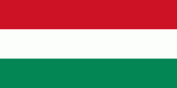
| Flag of Hungary | |
The territory of present-day Hungary has for centuries been a crossroads for various peoples, including Celts, Romans, Germanic tribes, Huns, West Slavs and the Avars. The foundation of the Hungarian state was established in the late 9th century AD with the conquest of the Carpathian Basin by Hungarian grand prince Árpád. His great-grandson Stephen I ascended the throne in 1000, converting his realm to a Christian kingdom. By the 12th century, Hungary became a regional power, reaching its cultural and political height in the 15th century. Following the Battle of Mohács in 1526, it was partially occupied by the Ottoman Empire (1541–1699). Hungary came under Habsburg rule at the turn of the 18th century, later joining with the Austrian Empire to form Austria-Hungary, a major power into the early 20th century.
Currency / Language
| ISO | Currency | Symbol | Significant figures |
|---|---|---|---|
| HUF | Hungarian forint | Ft | 2 |
| ISO | Language |
|---|---|
| HU | Hungarian language |


